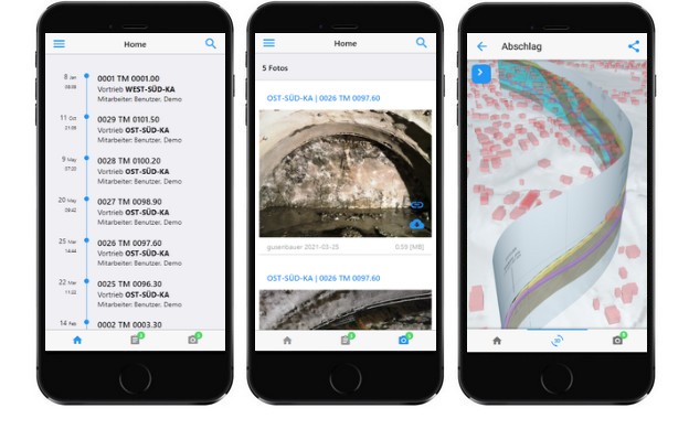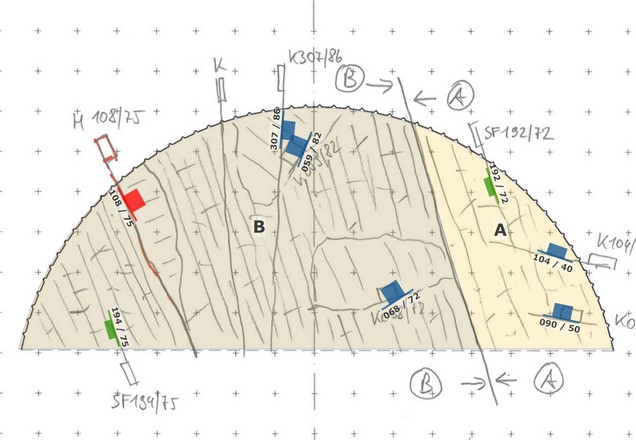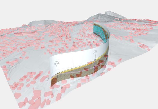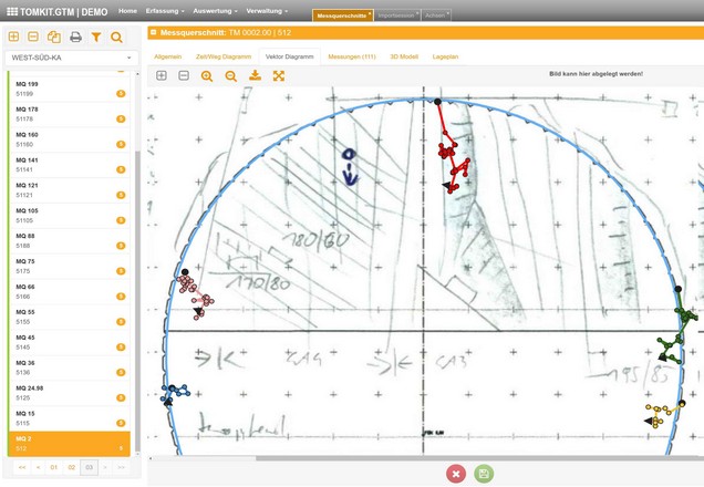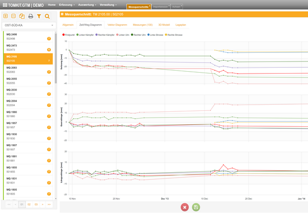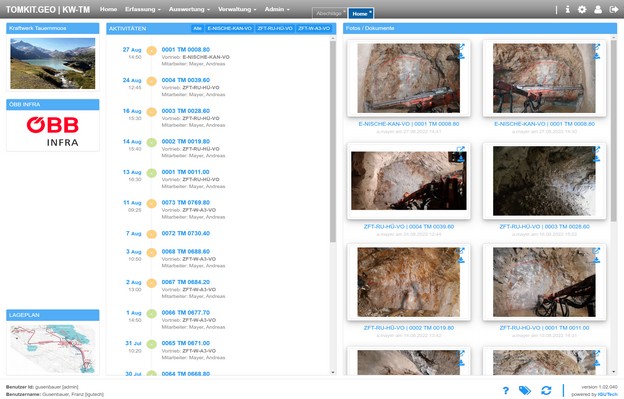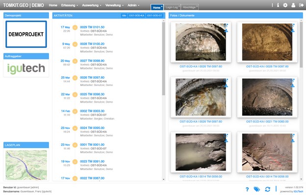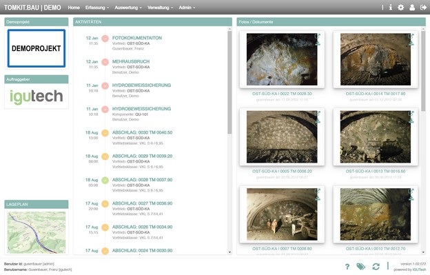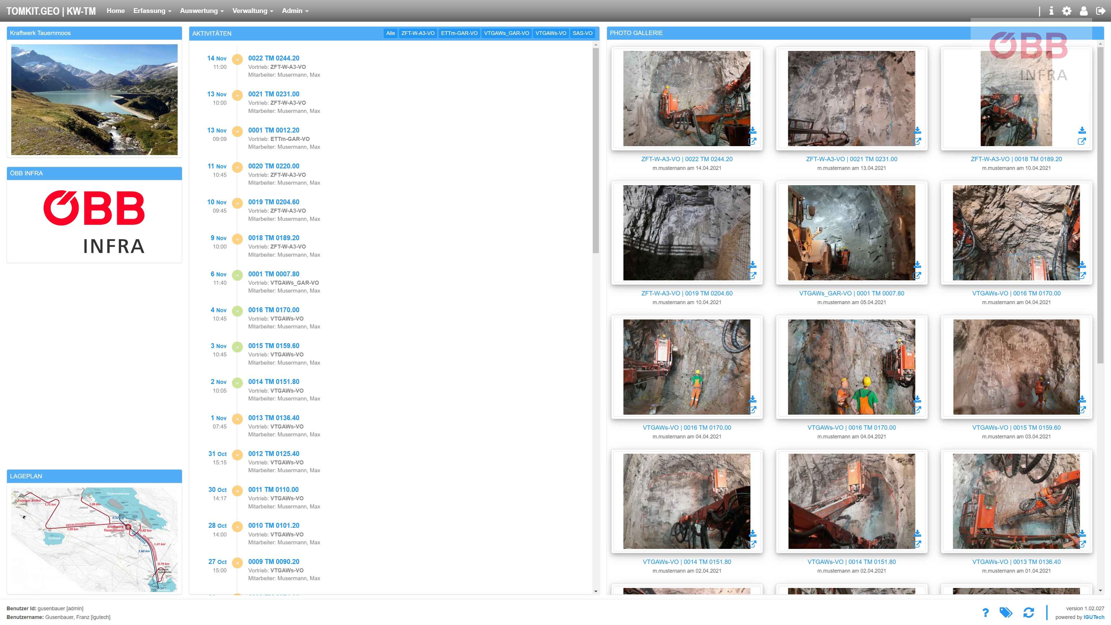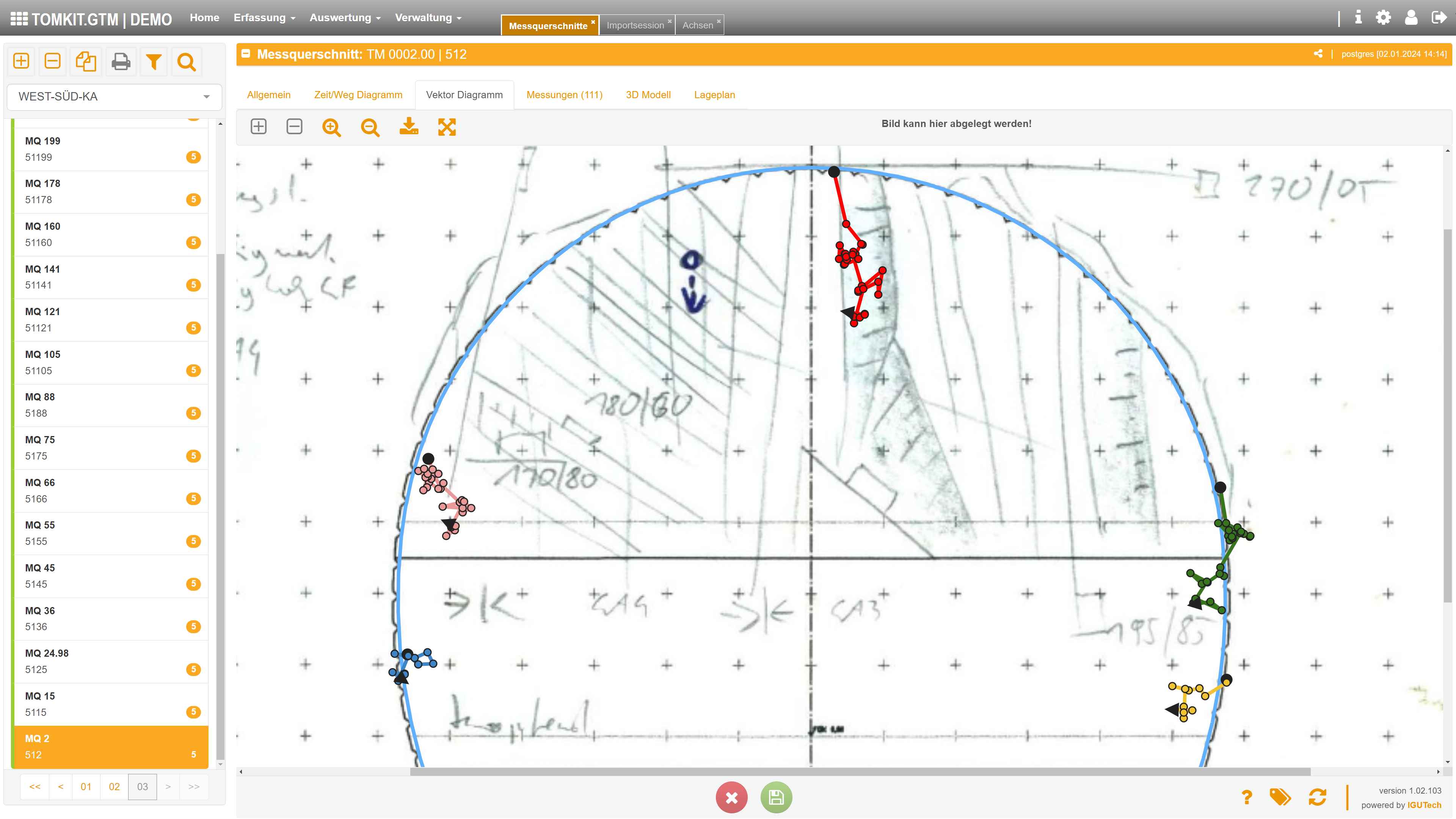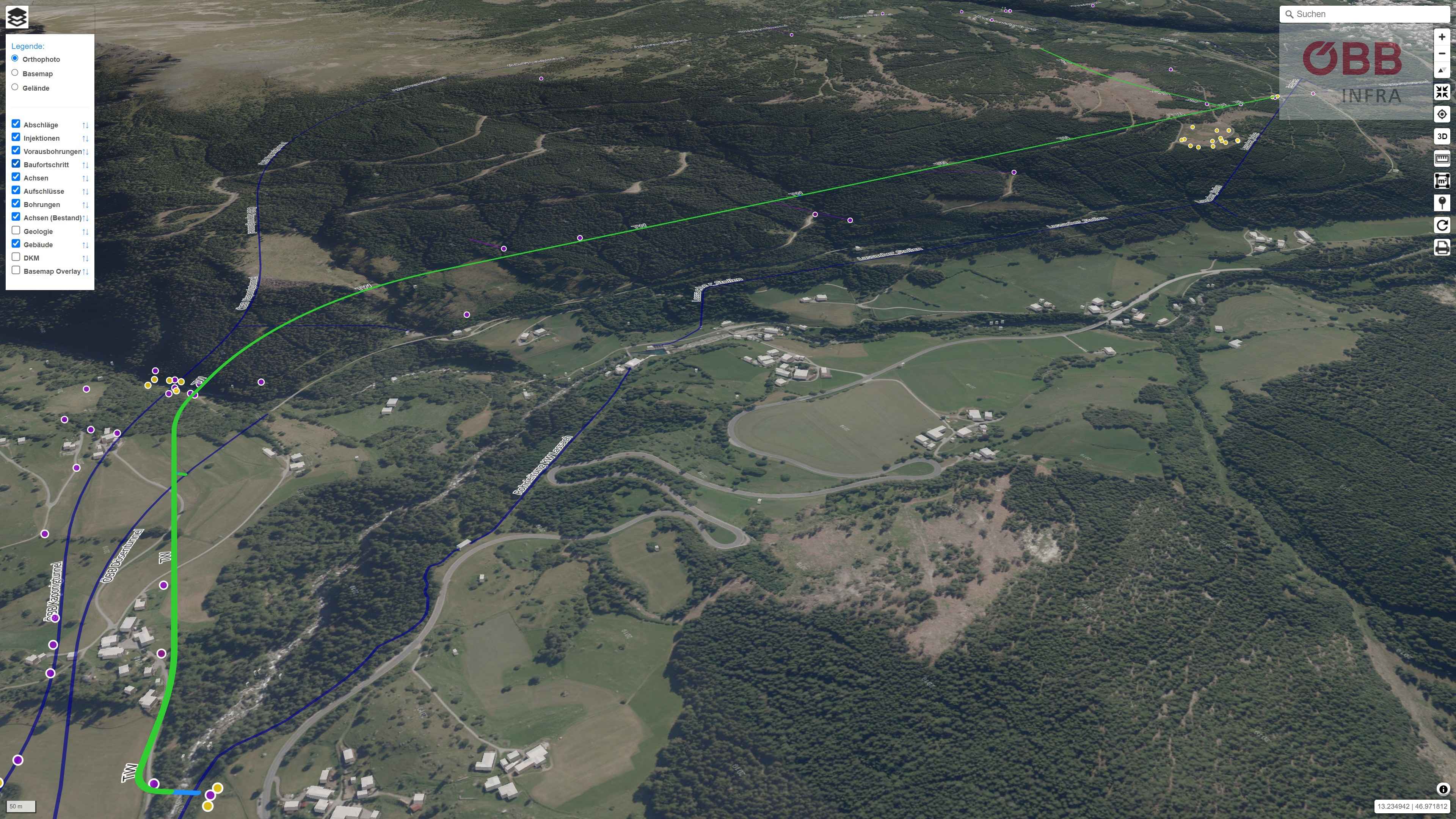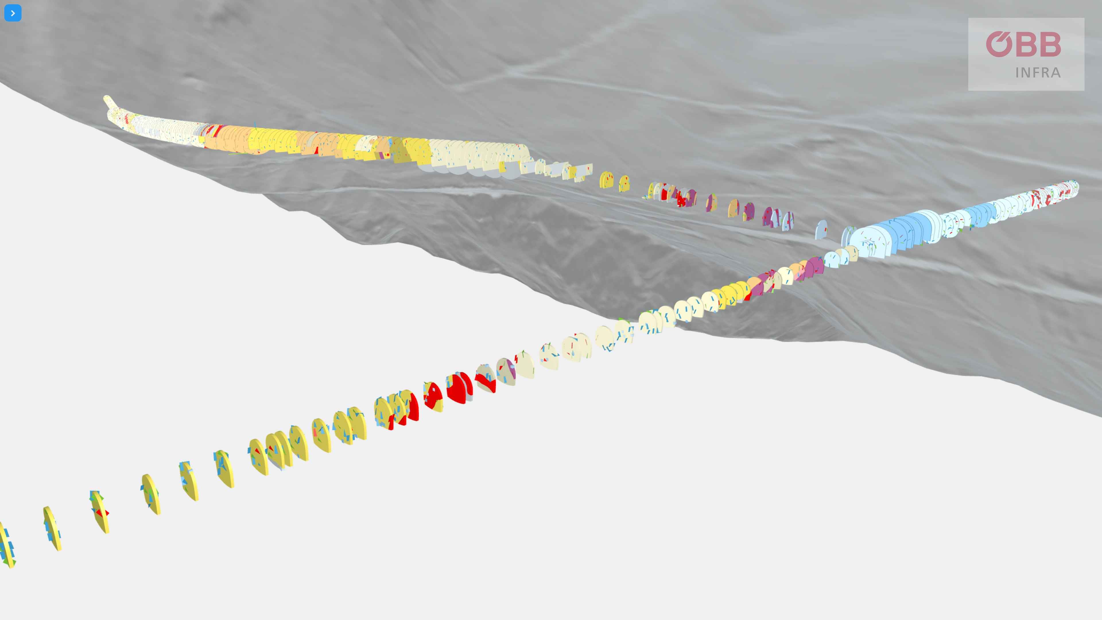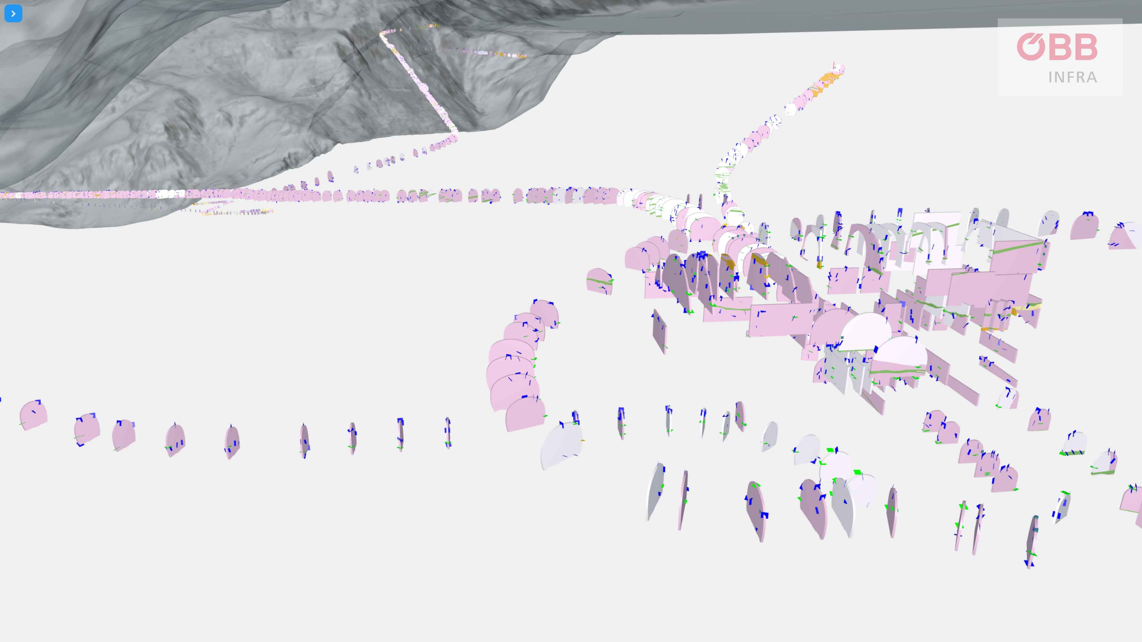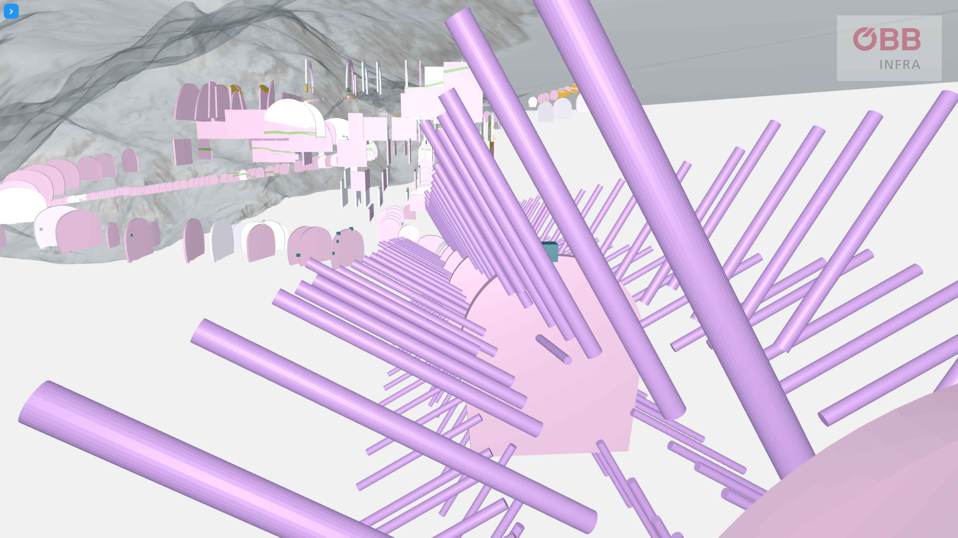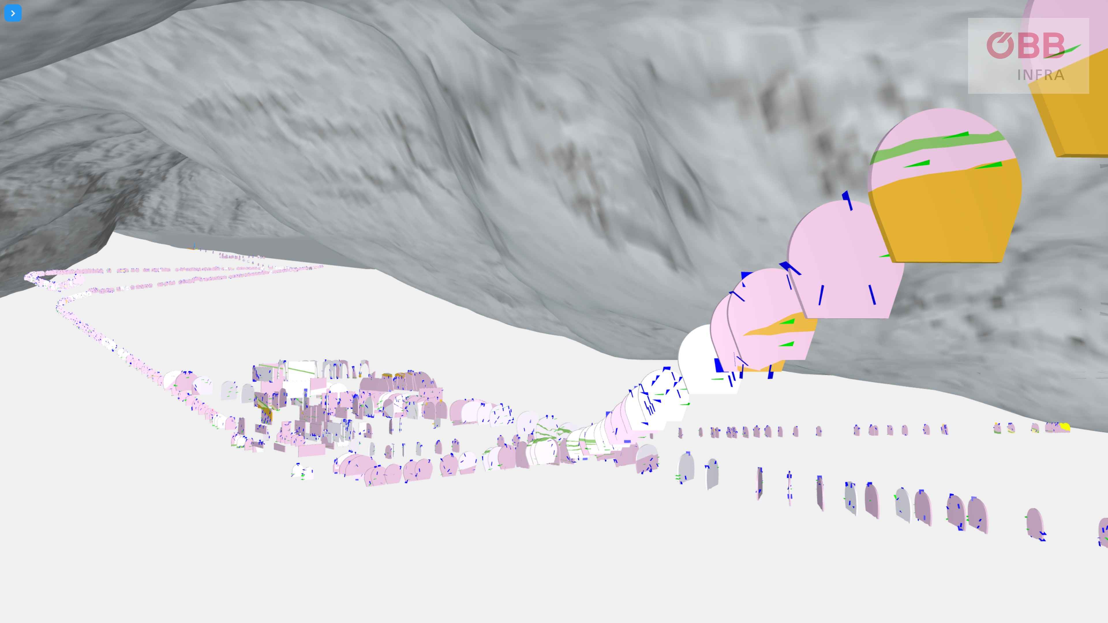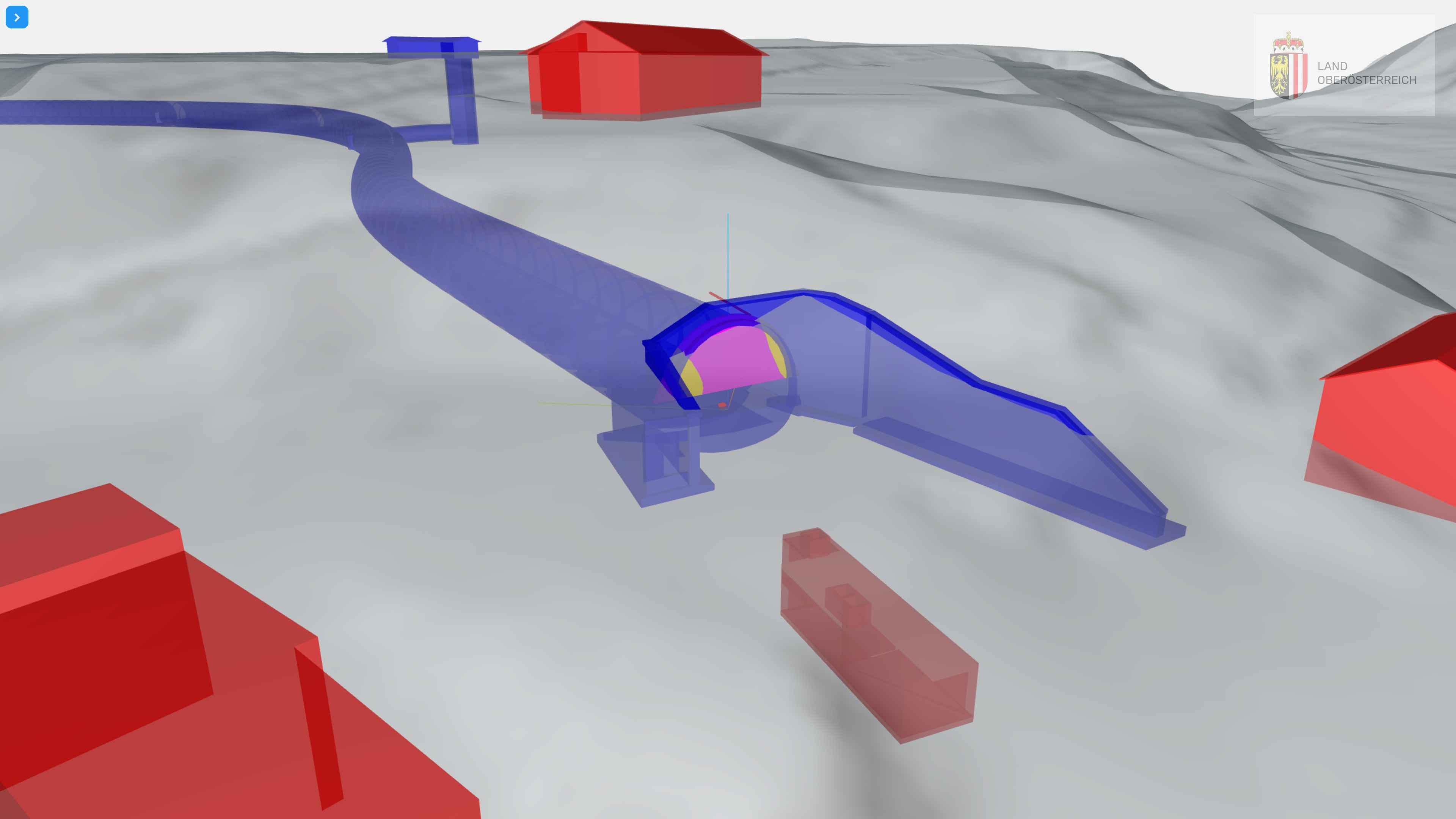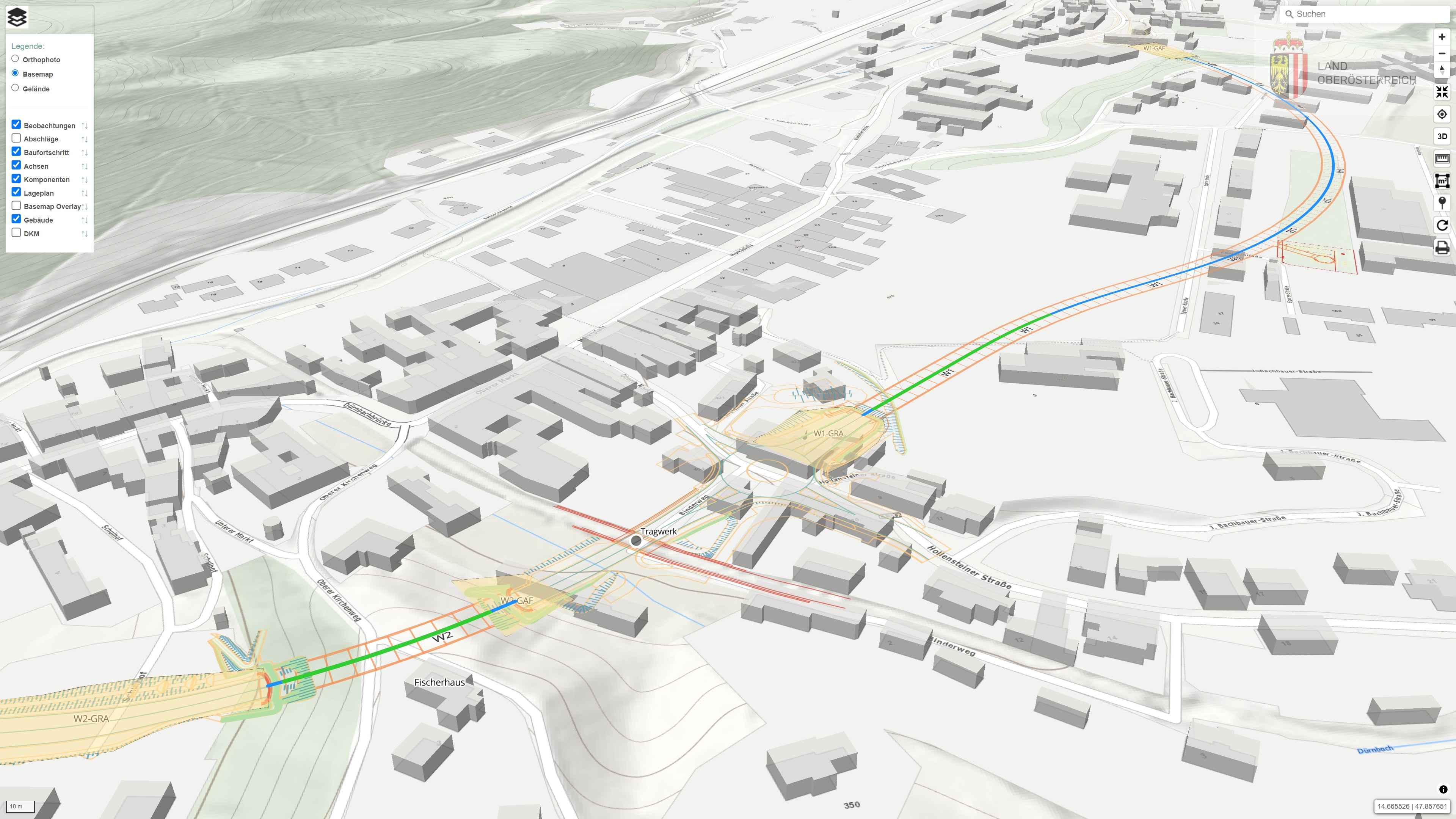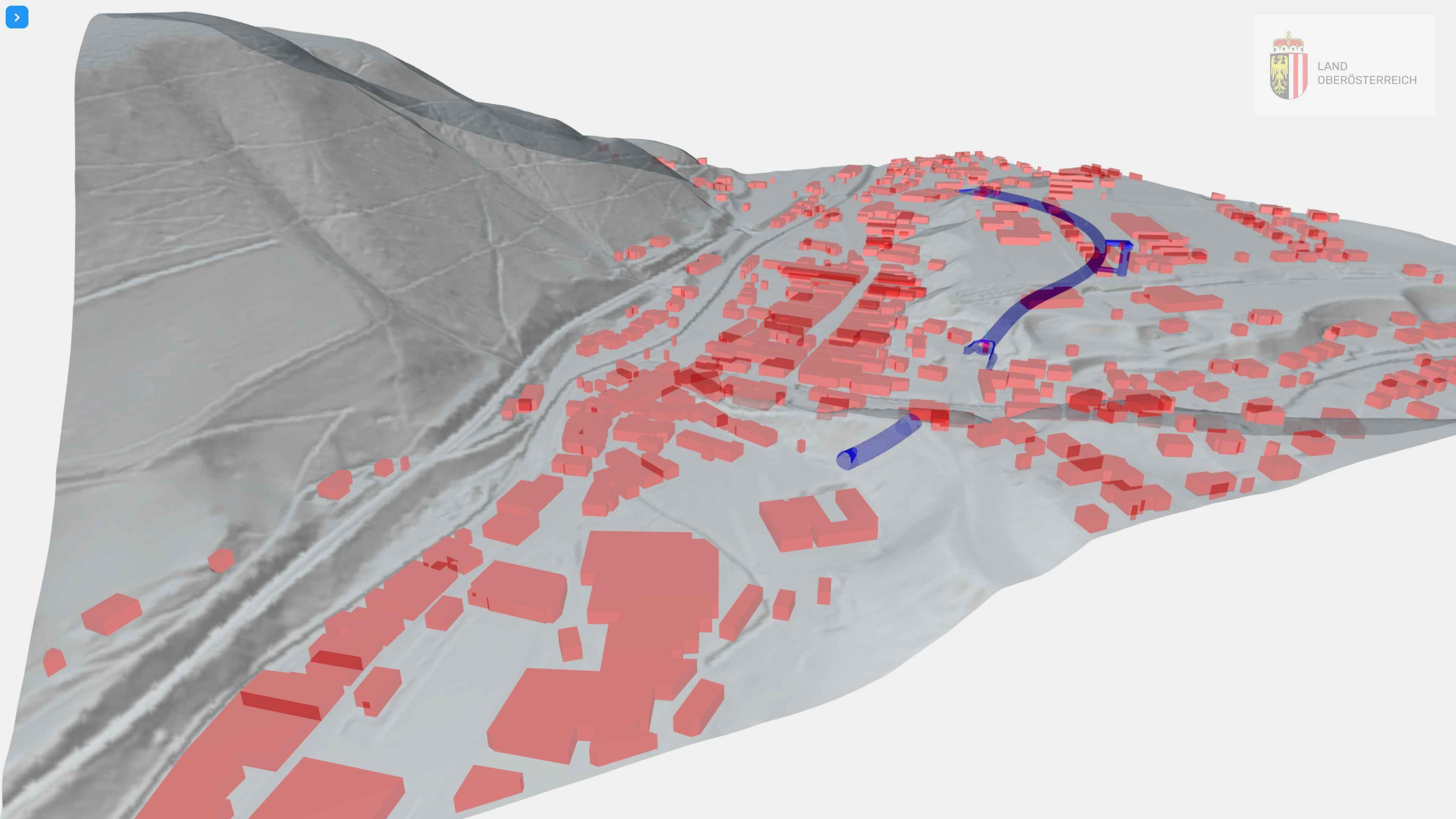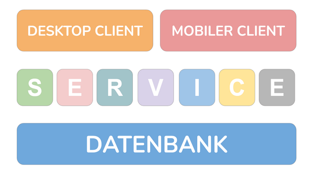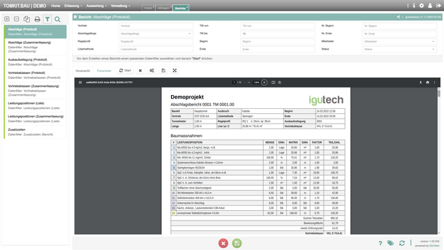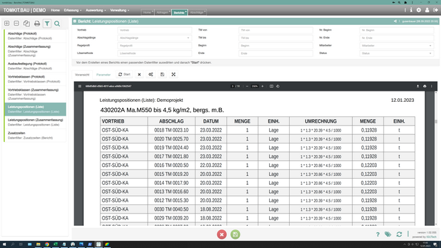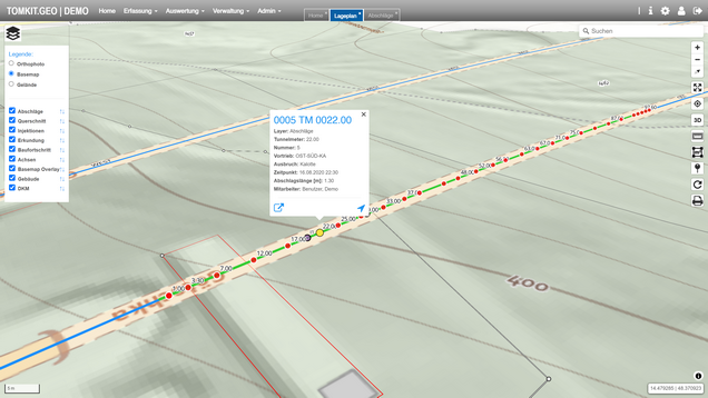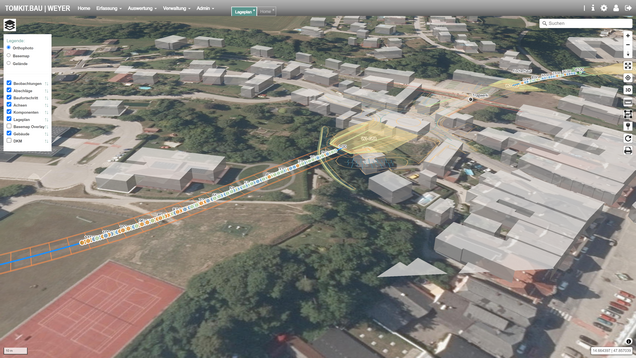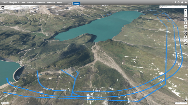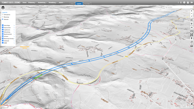
Übersichtliche Verwaltung im Büro
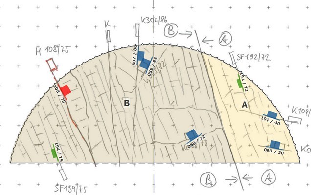
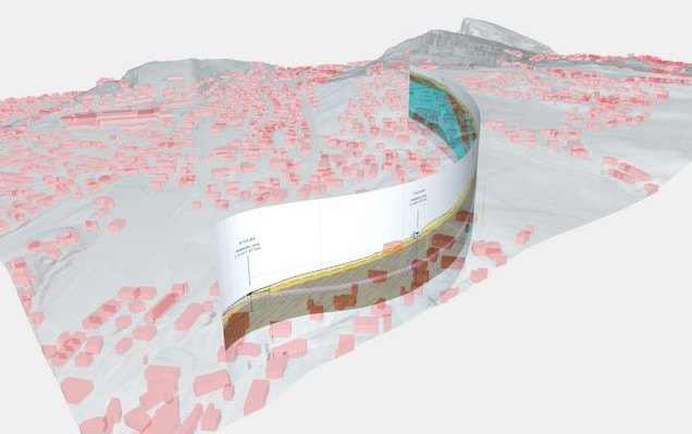
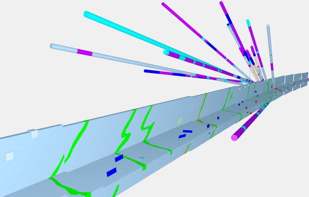
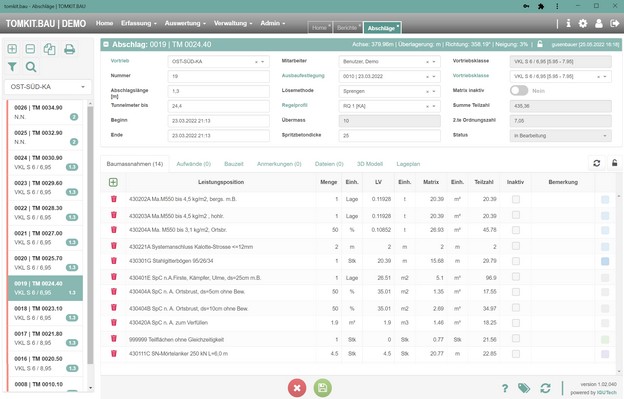
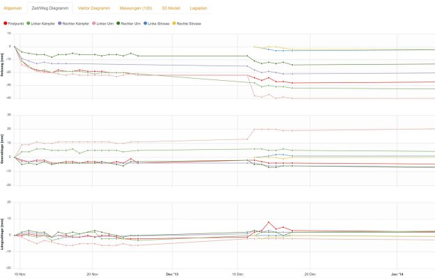
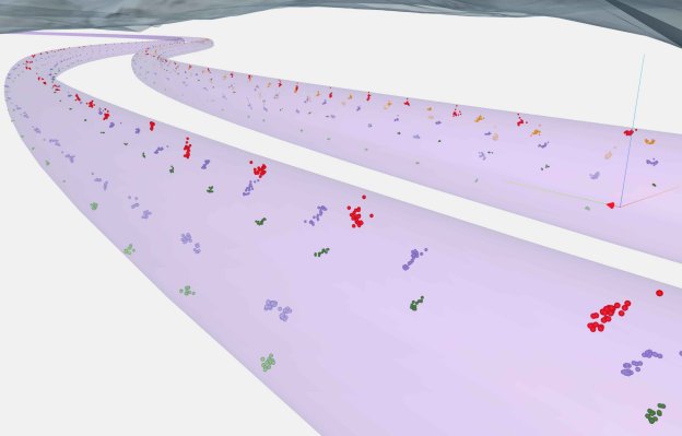
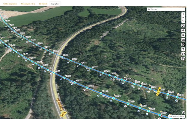
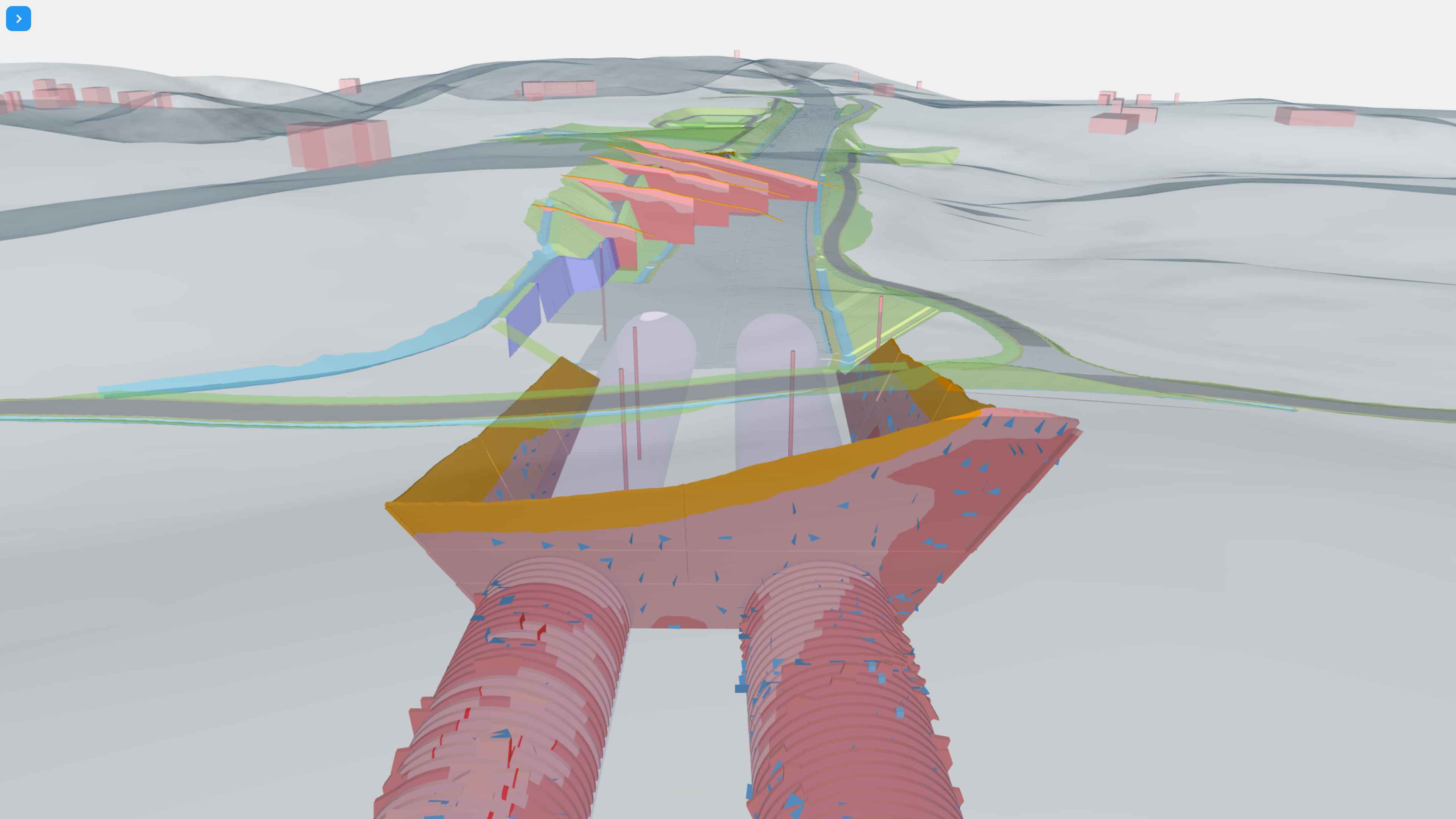
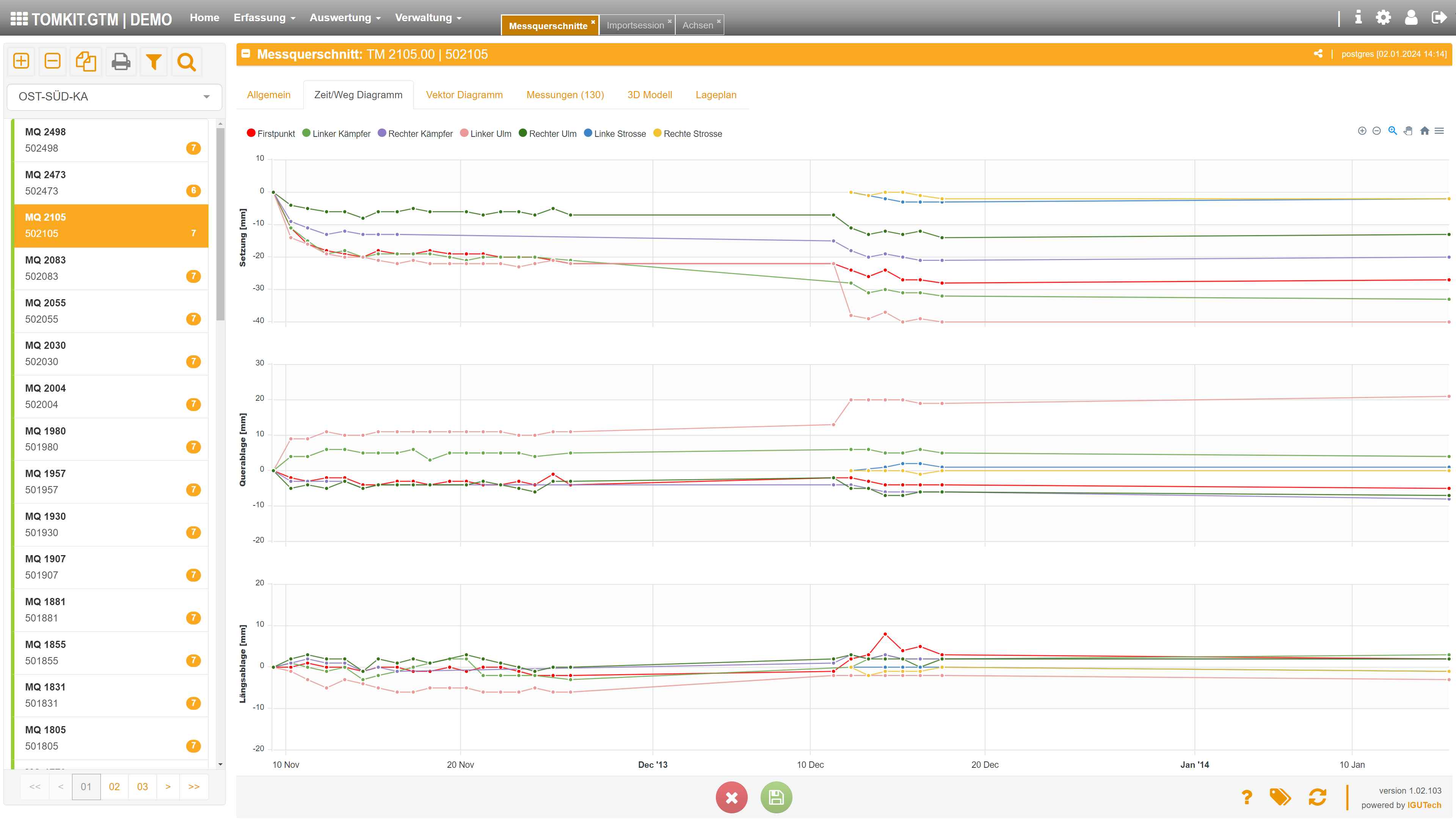
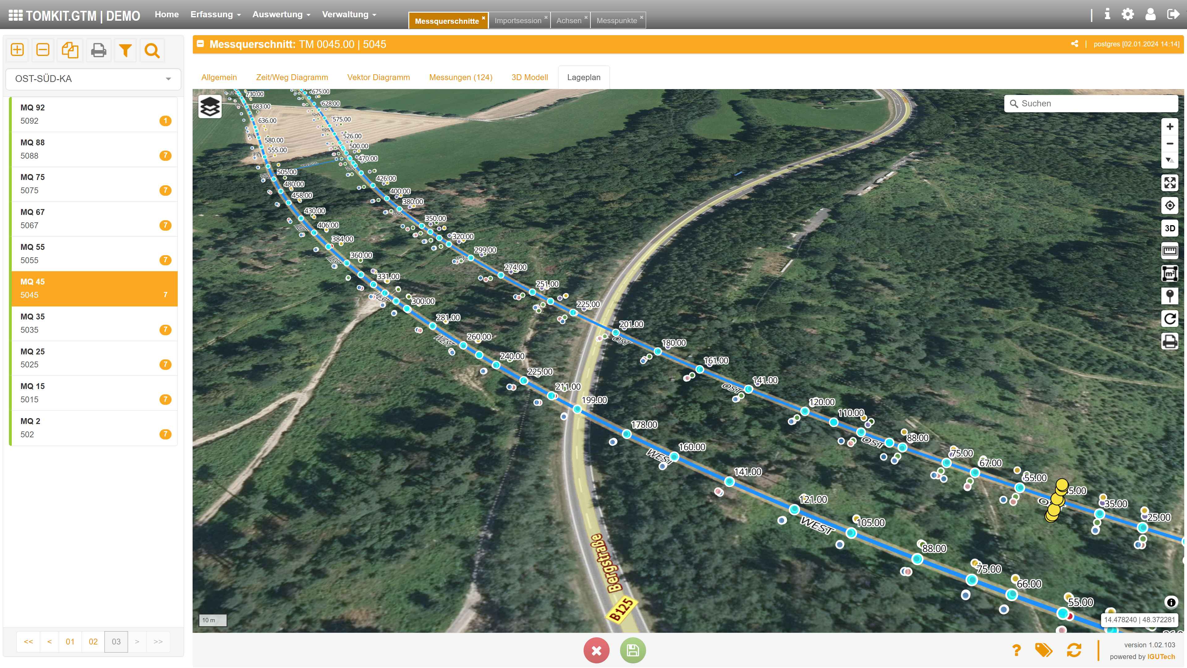
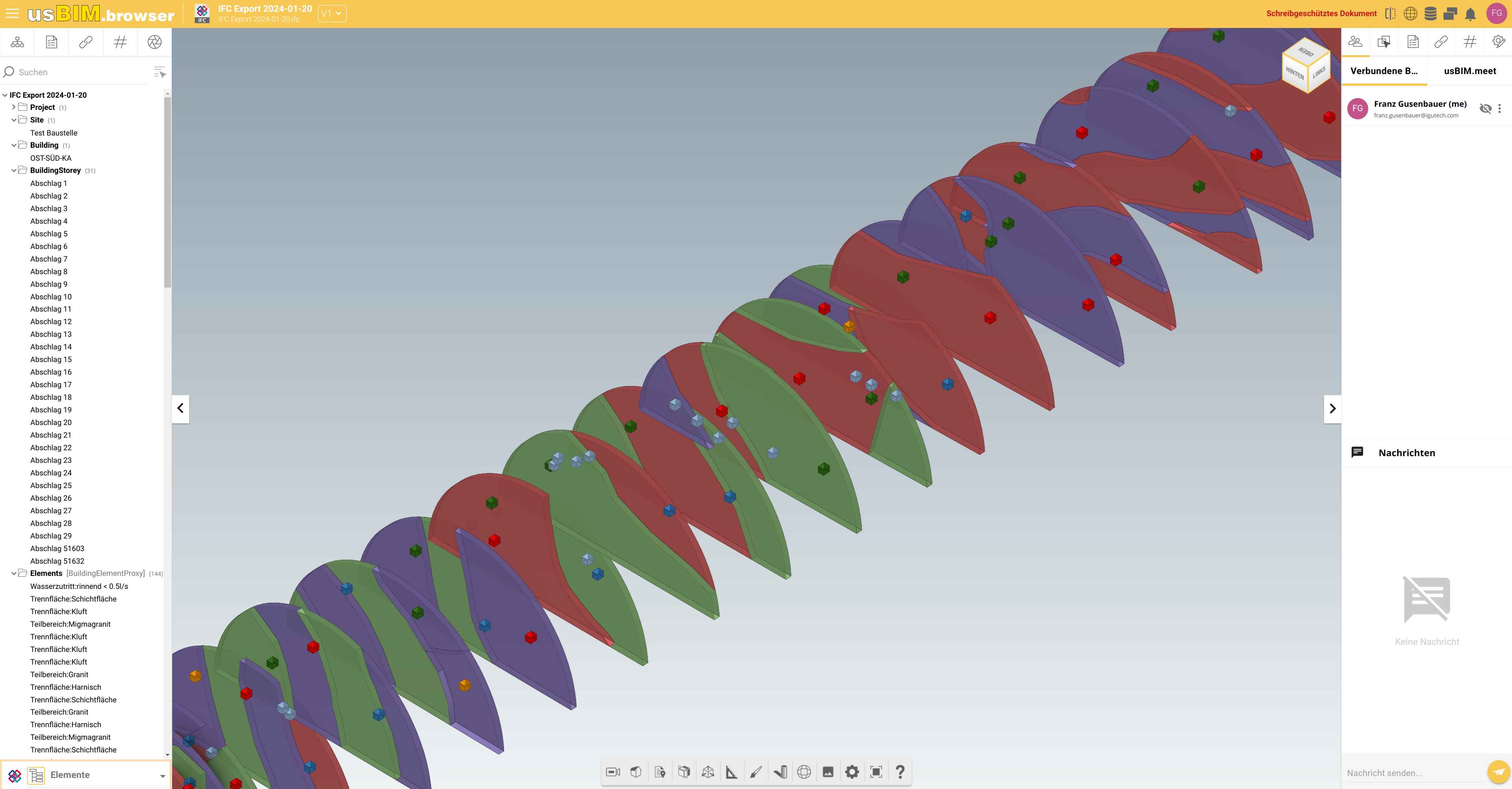
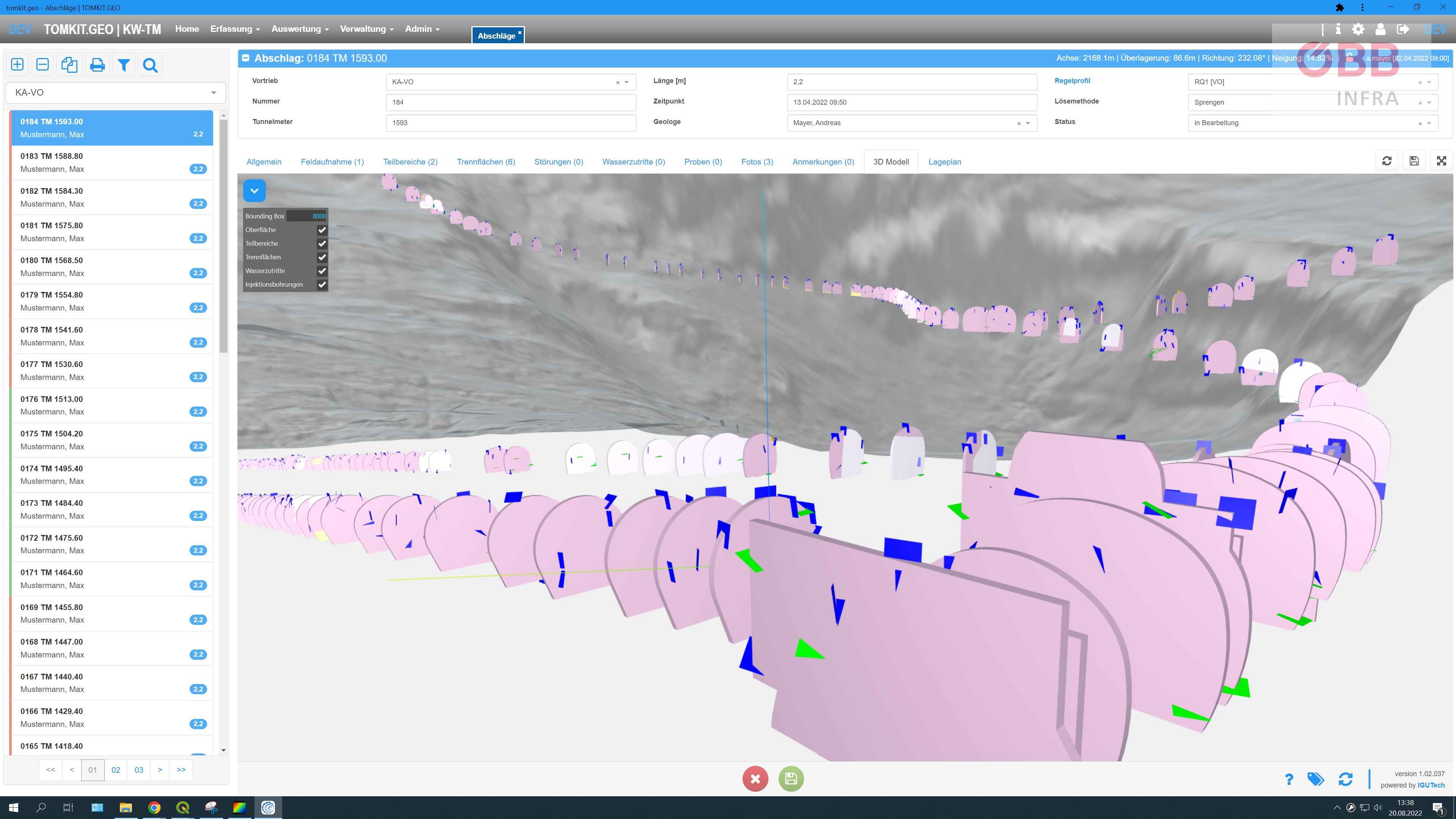
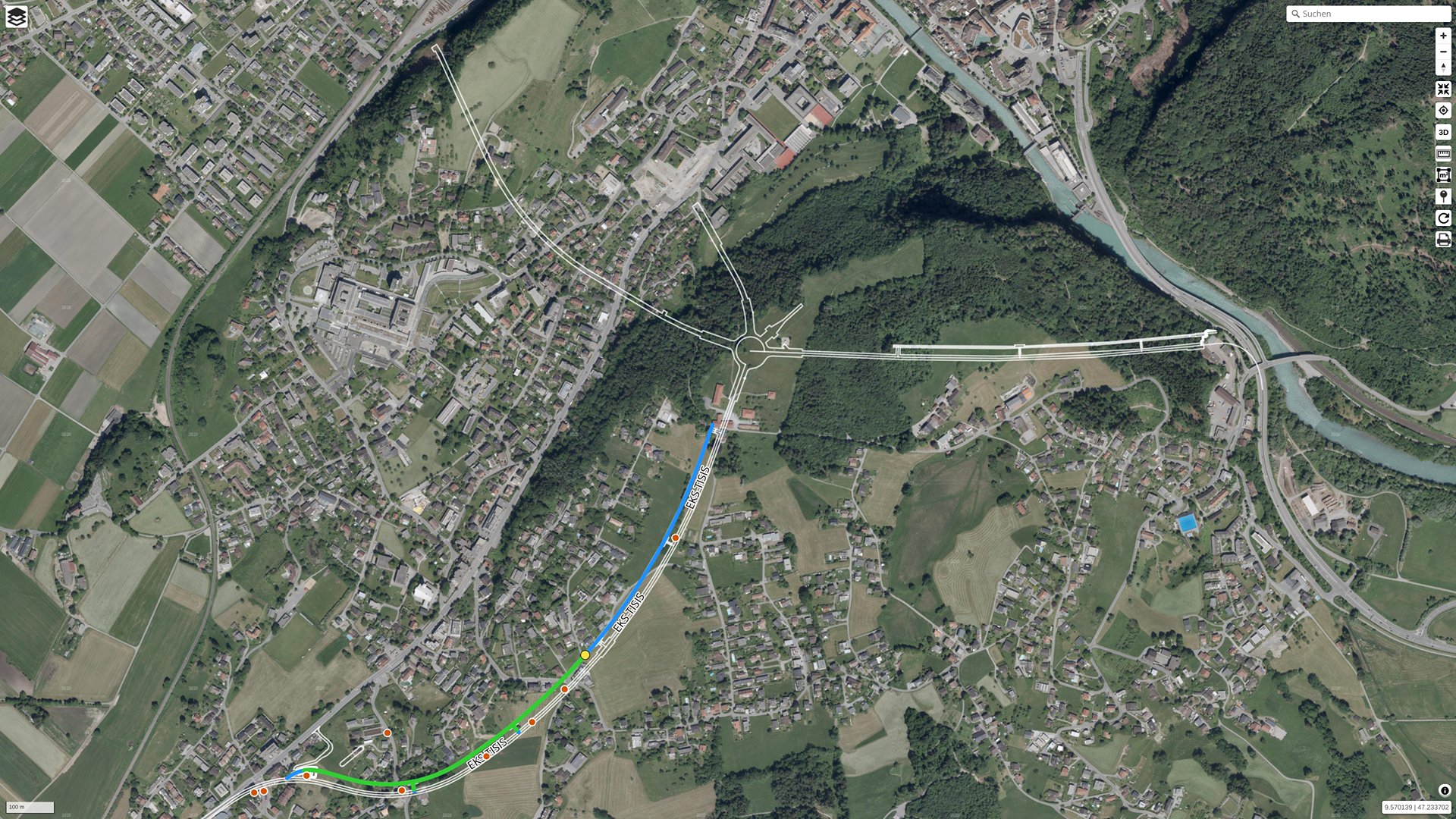
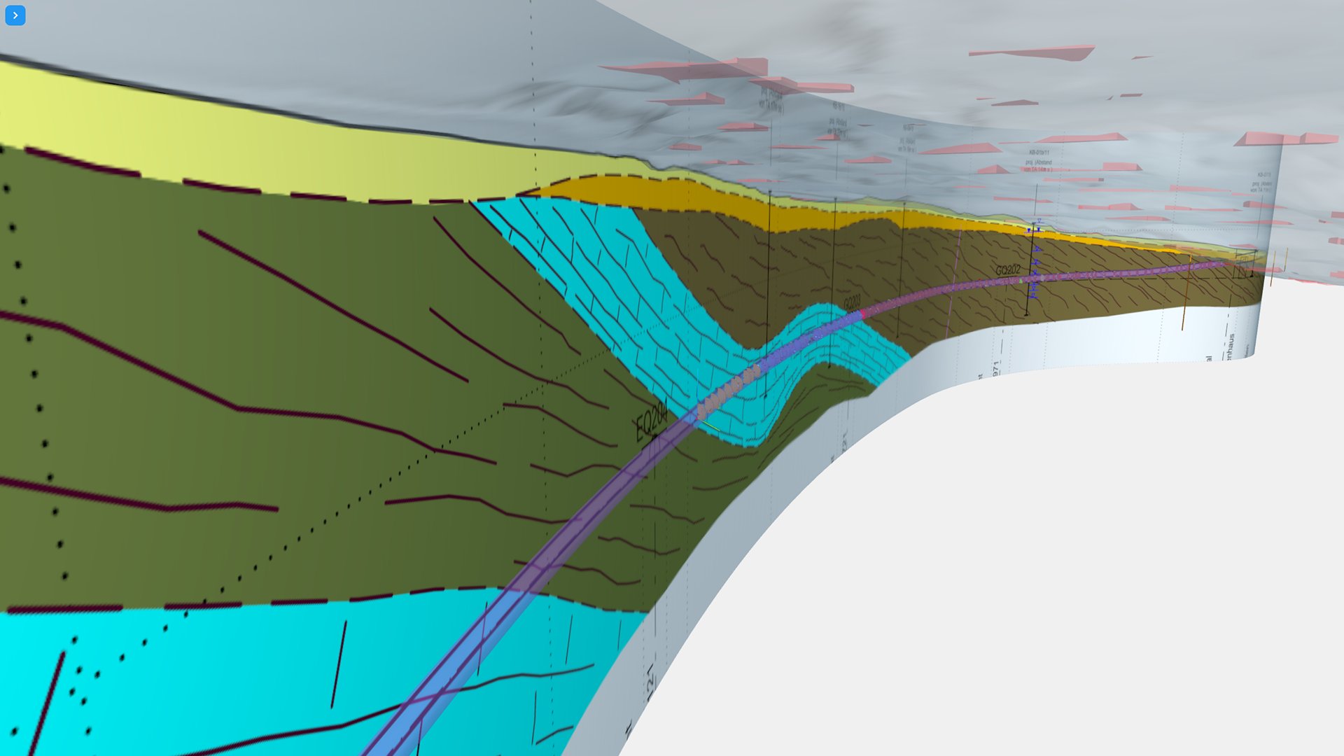
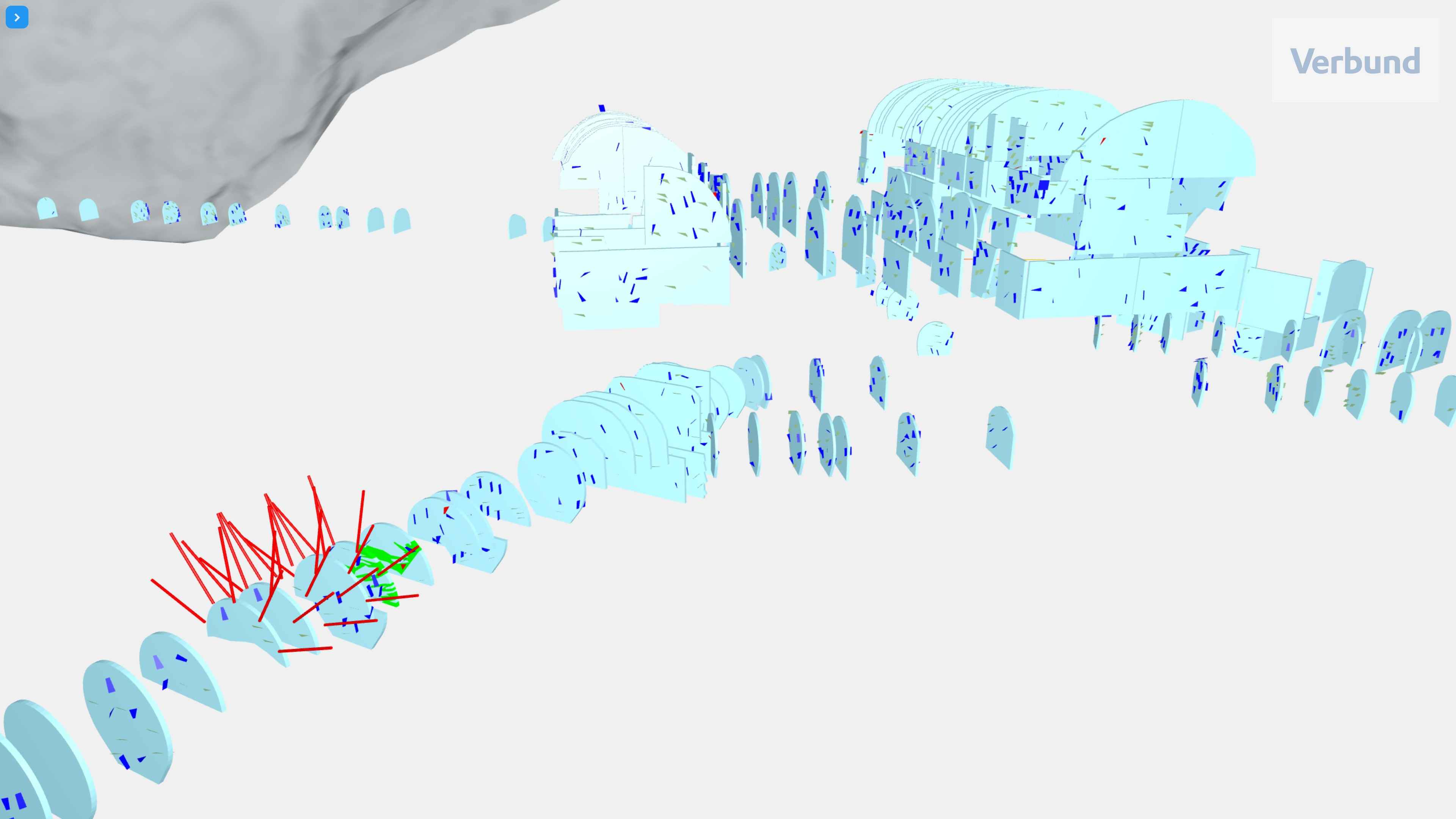
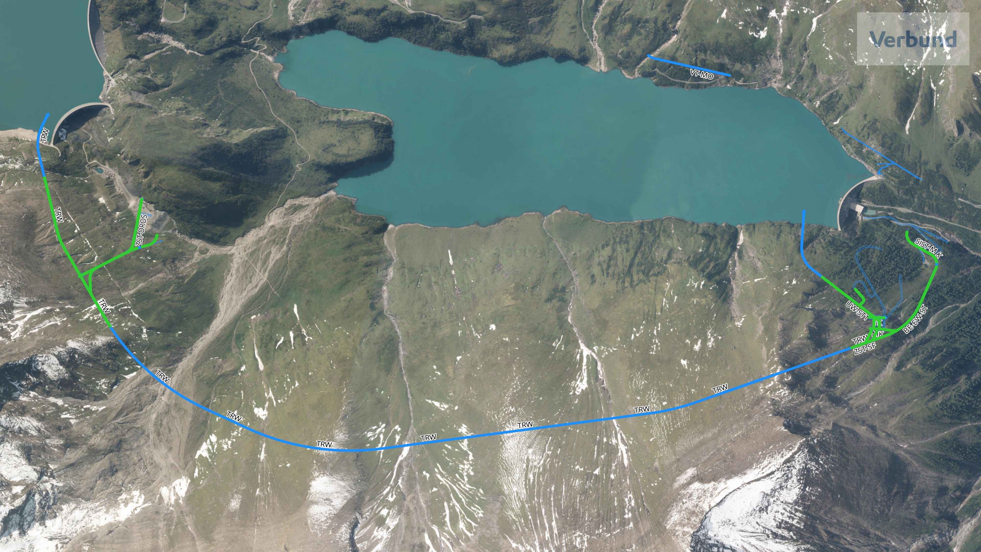
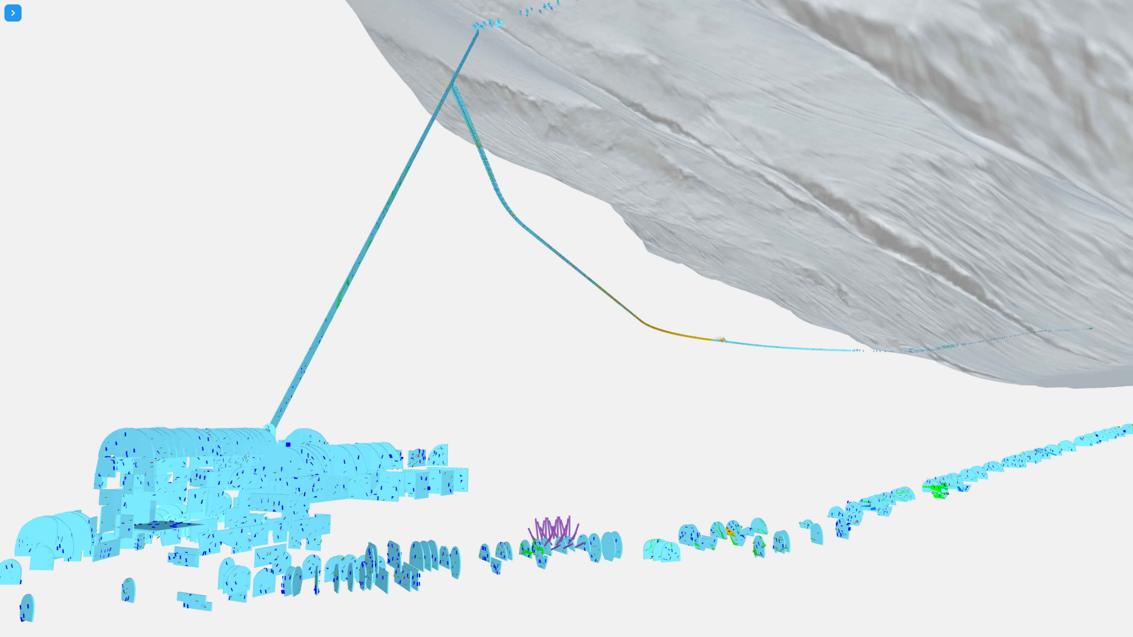
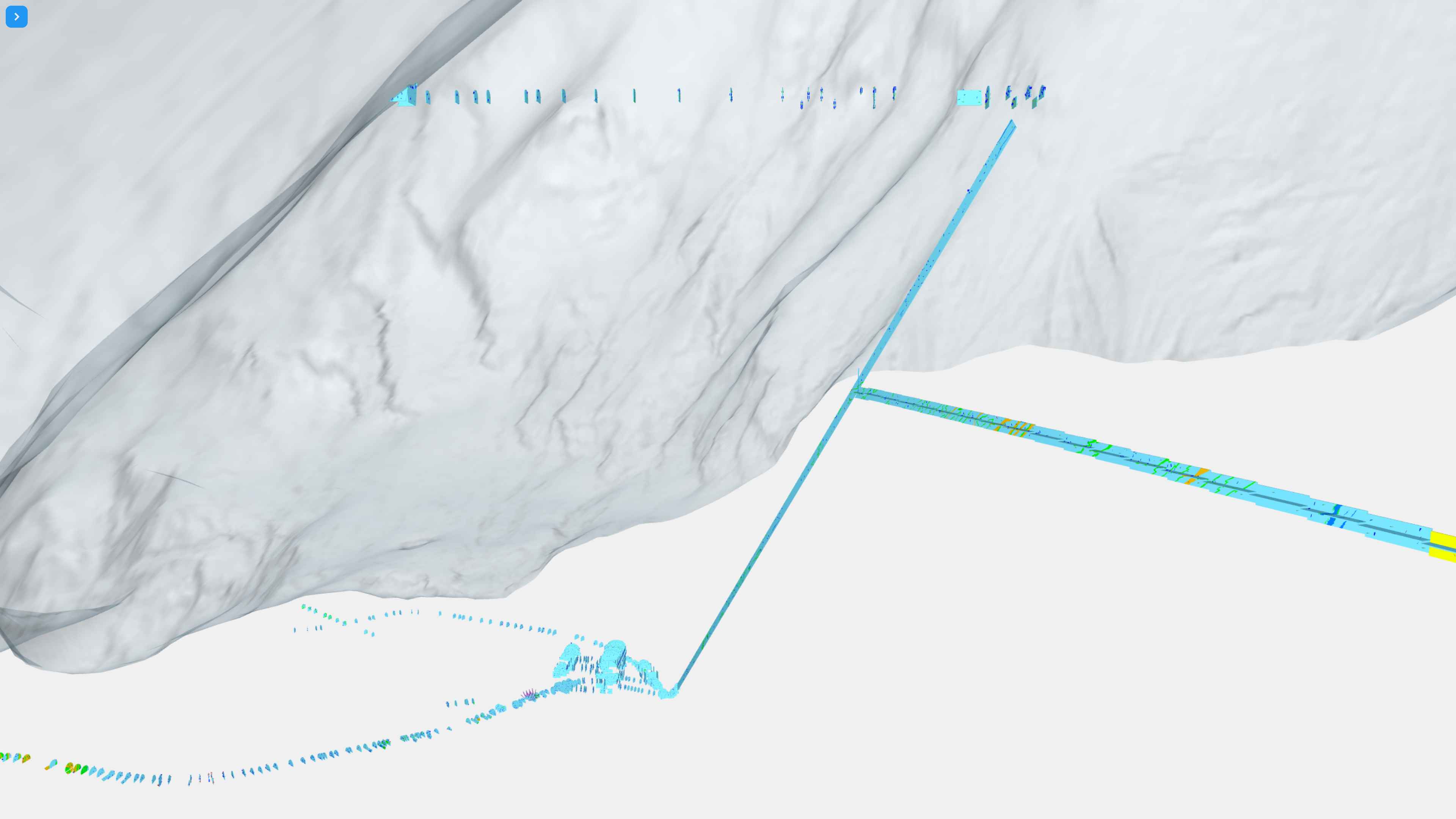
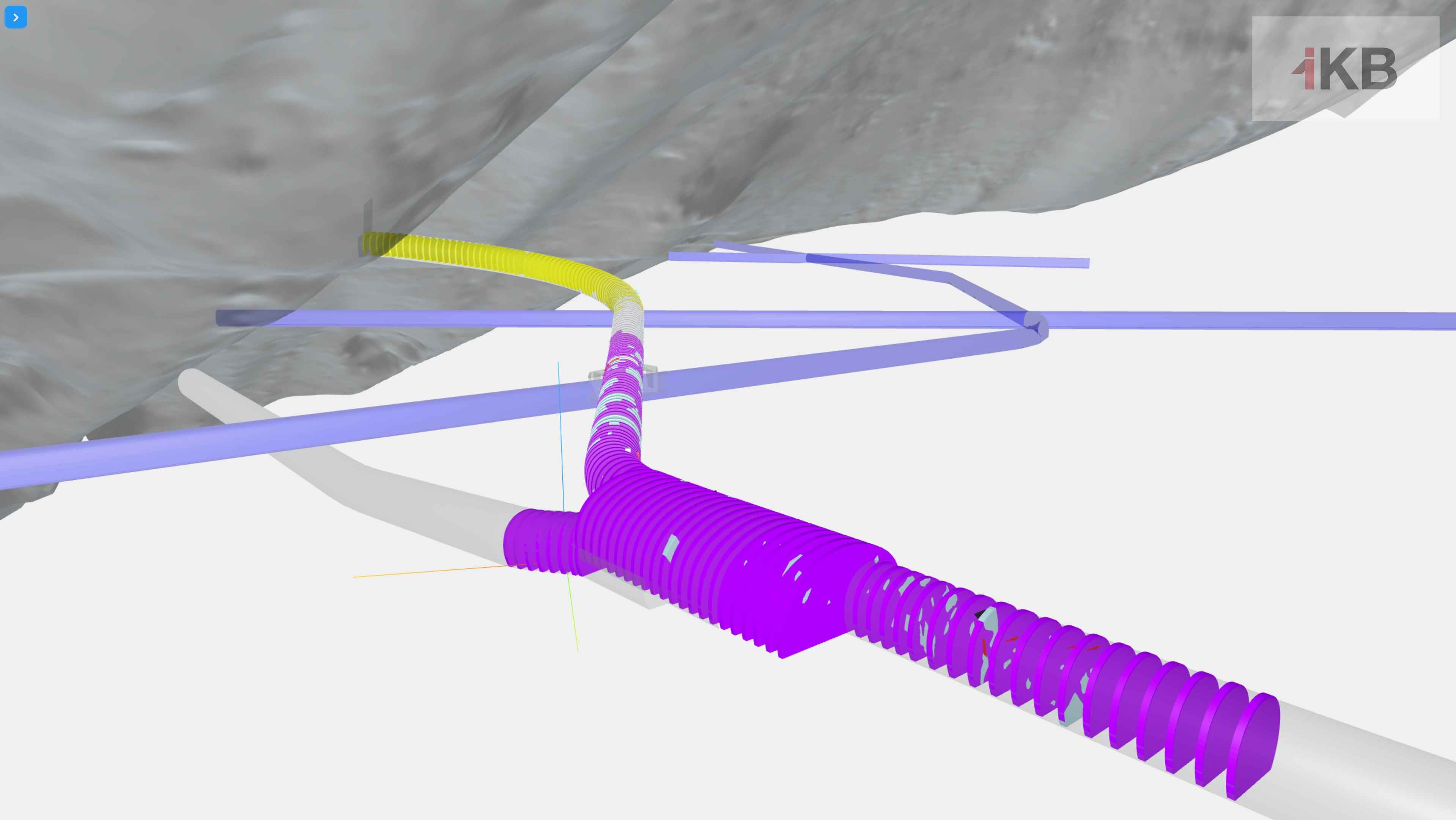
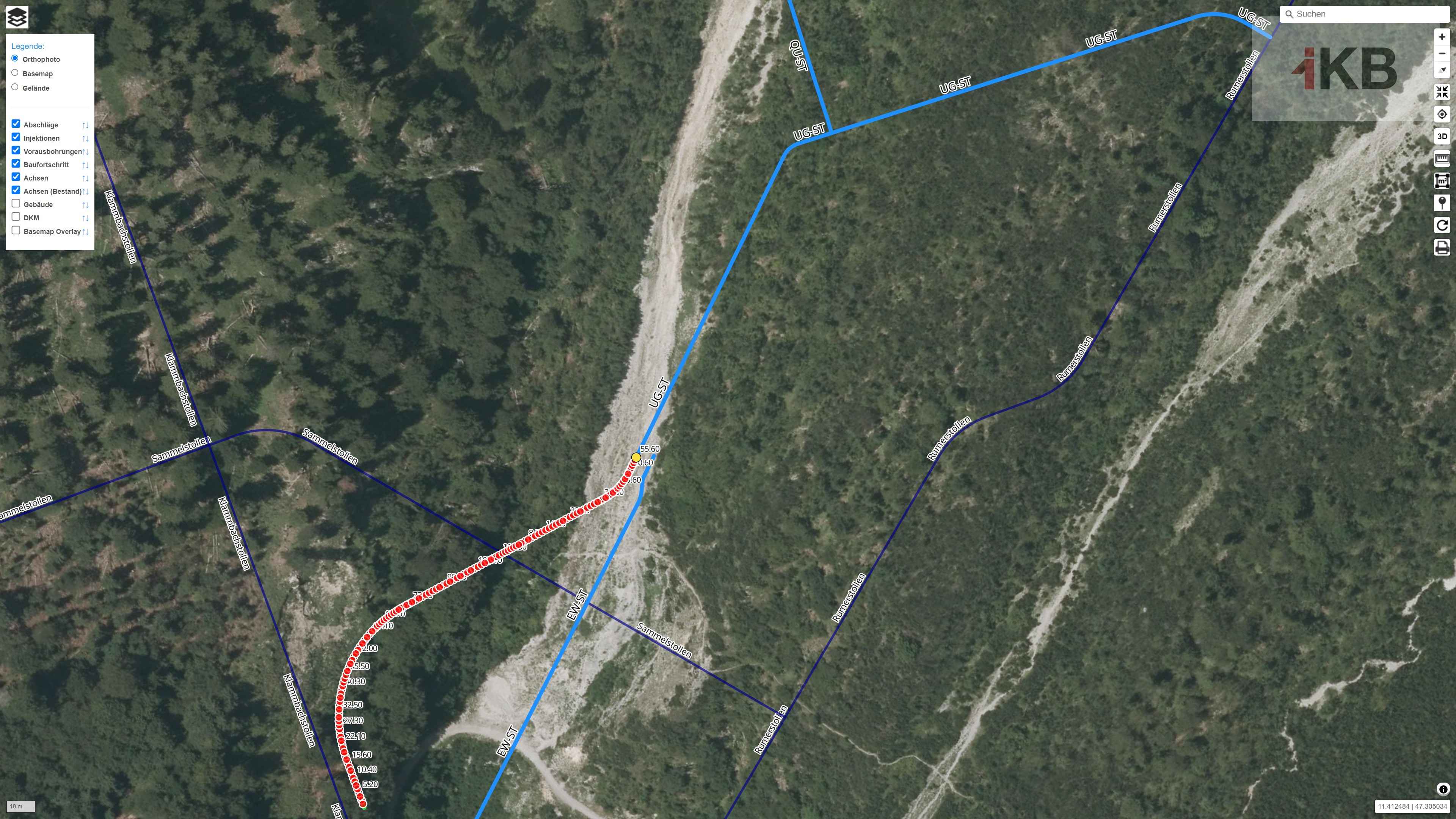
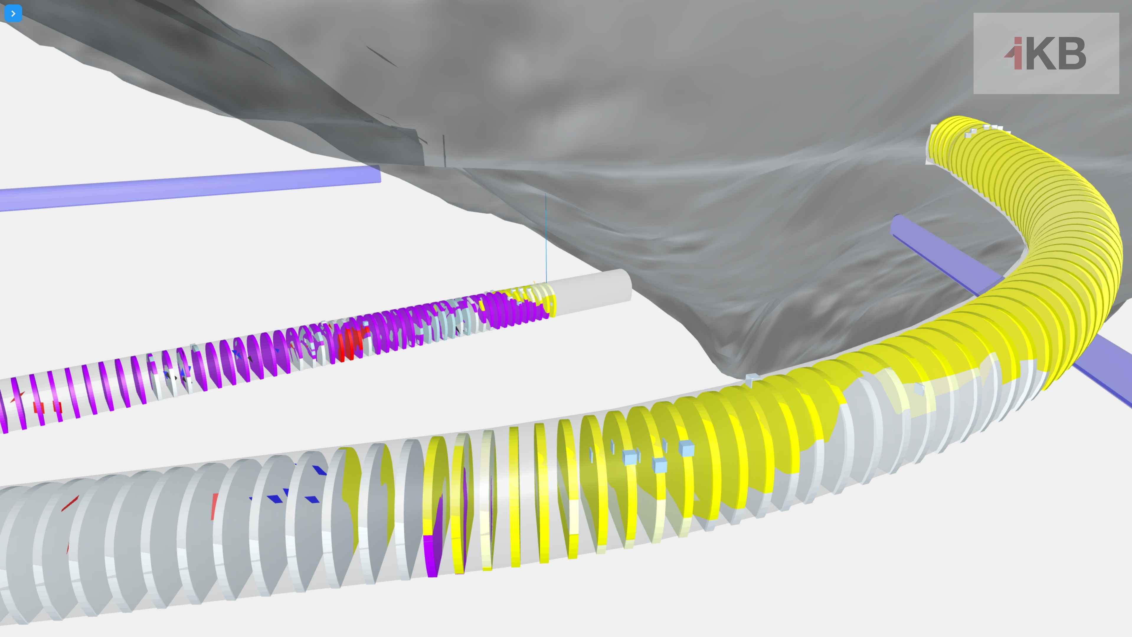
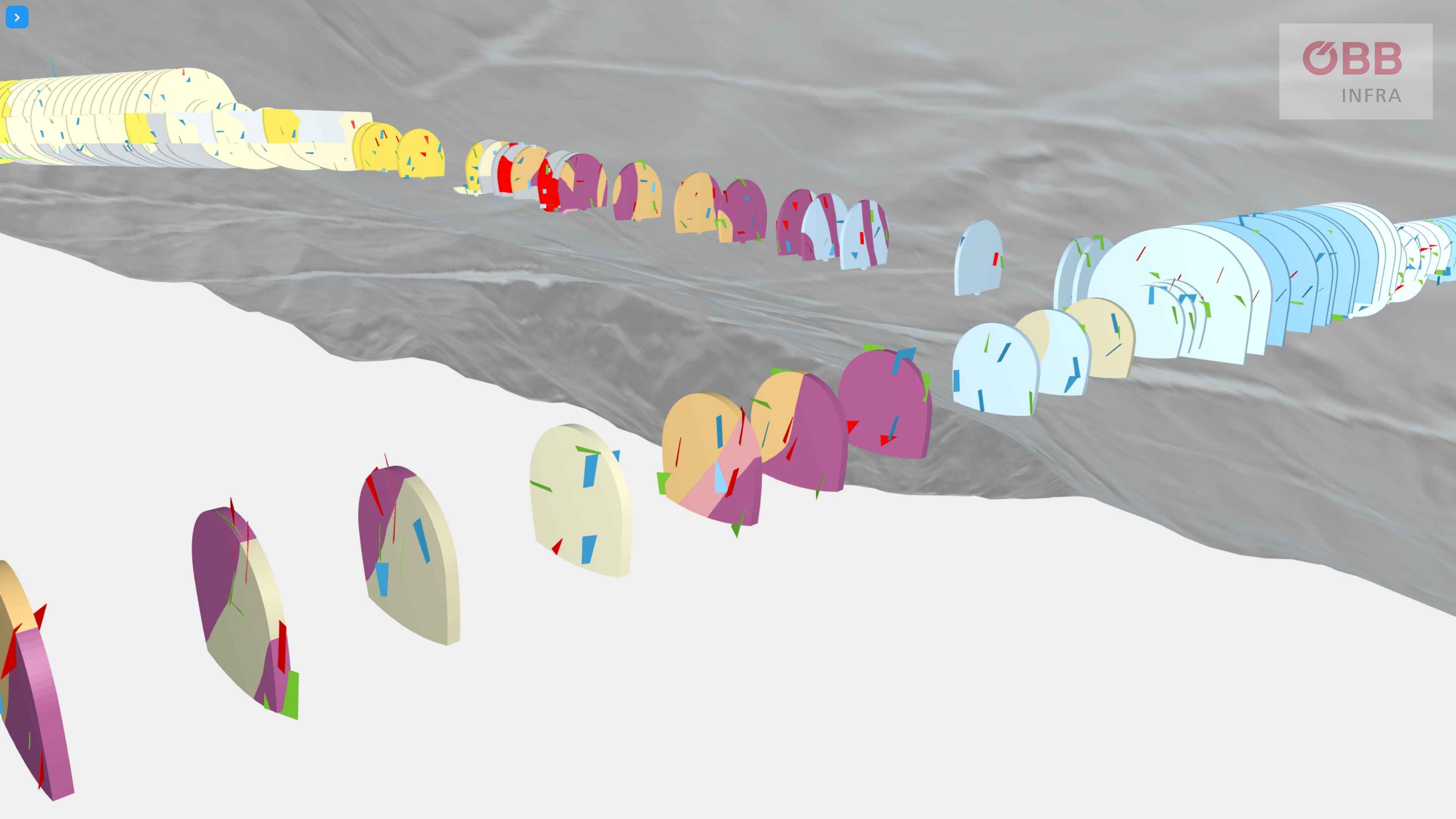
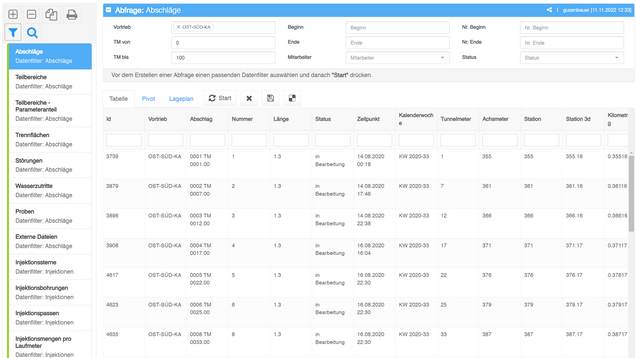
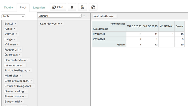
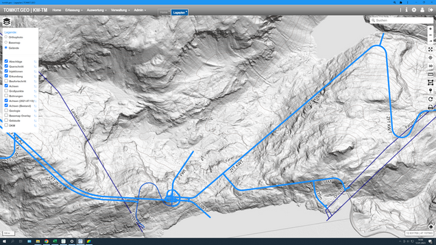
Die Desktop App ist eine web-basierte Browser Applikation auf Basis von moderner Web-Technologie. Er fungiert als Datenzentrale und ermöglicht eine Gesamtsicht auf alle Daten. Abhängig von Benutzerberechtigungen können Datensätze rasch und einfach verändert werden. Ein integrierter GIS-Viewer erleichtert die Navigation innerhalb der Datensätze.
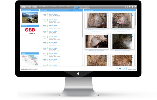
Easy administration in the office
The Desktop App is a web-based browser application based on modern web technology. It acts as a data center and enables an overall view of all data. Depending on user authorizations, data sets can be changed quickly and easily. An integrated GIS viewer makes navigation within the data sets easier.